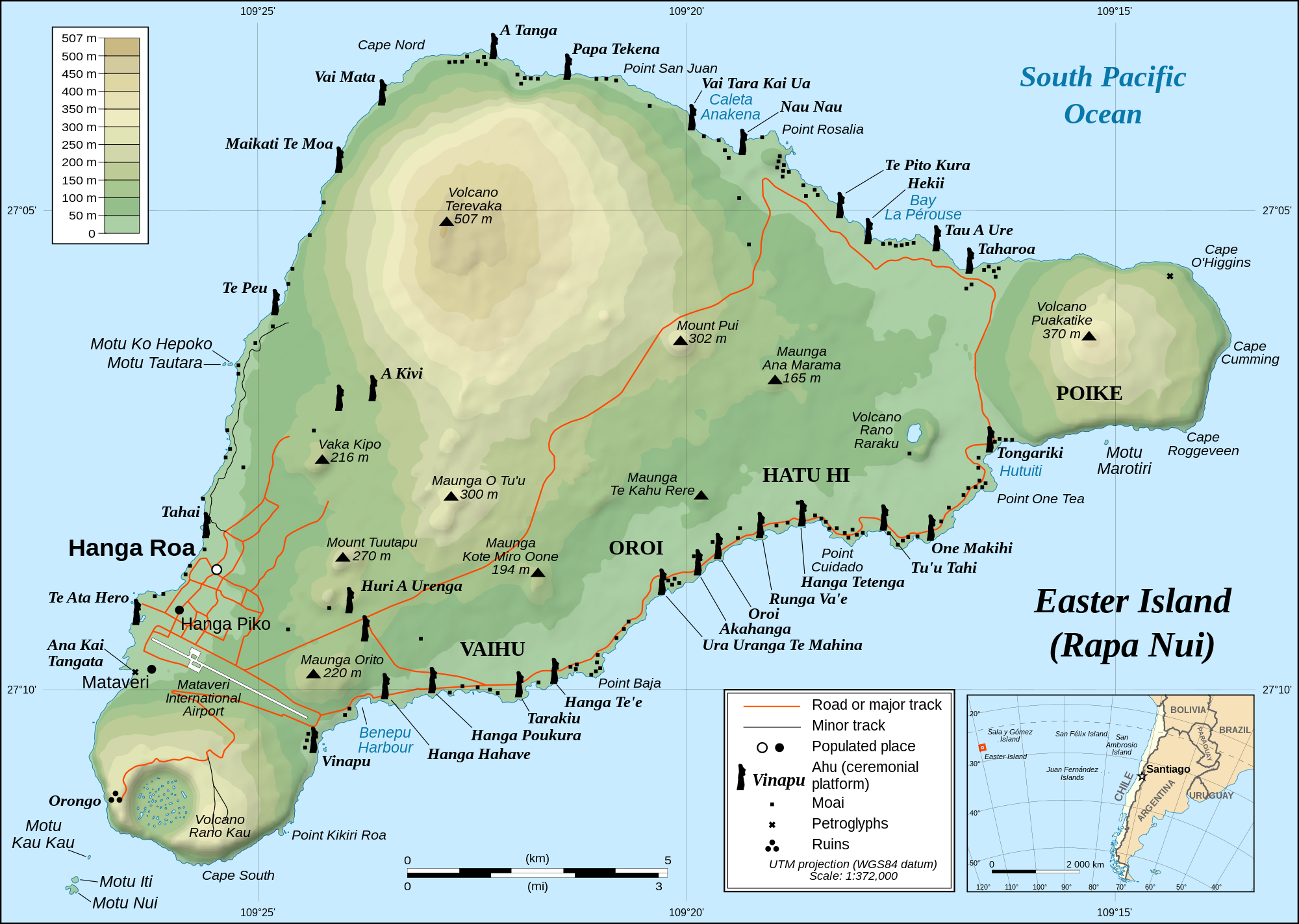
First, a map:
 |
| Easter Island. The map I used in my activity has a few embarrassing errors (this one is fine). |
There are, as you can imagine, tons of moai on the island. These are statues built by the natives of their ancestors many, many years ago and are the most impressive things you will see. Most were torn down and have subsequently been restored, but a few impressive ones are broken.
(Remember: you can click on the pictures to see them larger.)
 |
| Broken moai at Ahu Akahanga |
All of these moai were constructed at one place: Rano Raraku, the remains of a volcano that now hosts a lake. The rocks on one side of the volcano was carved up into these great statues, which were then transported all across the island. We had with us a friend and guide, Edmundo Edwards, who told us these great stories and taught us a ton about the history of the island.
 |
| Moai at Rano Raraku. |
 |
| The lake atop Rano Raraku. |
Ahu Tongariki, picture below, is one of the better known moai sites. This one has 15 huge moai.
 |
| Ahu Tongariki |
Most moai face inland, though a few, like Ahu Akivi picture below do not. It's not clear to me why this is, but it's an interesting curiosity. Somewhat unusual is that the stones around Ahu Akivi are all river stones, but there are no rivers on the island (they were recently imported from the mainland).
 |
| Ahu Akivi |
The highest point of the island, Maunga Terevaka, stands at 507 meters and is the tallest mountain in a 4000 km radius. That shouldn't be too surprising considering there is practically no land (just a few small islands) in that area. Easter Island is truly isolated. We climbed this hill at sunset as we were buffeted by the winds. It was a gruesome hike (I may be exaggerating here), but we made it.
 |
| Almost at the summit of Maunga Terevaka. |
There are two beaches on the island (the rest of the shore is rocky or cliffs). One was supposed to have pink sand, but it wasn't that pink. I've seen better beaches, but this one was still cool. And it had moai!
 |
| Moai at Anakena beach |
On our last day of tourism we visited the ruins of Orongo. This ceremonial village is located near the south at the edge of Rano Kau, which is picture below.
 |
| Rano Kau. The crater is about a mile in diameter. |
Orongo is important as it was used for the Birdman Cult on the island which replaced the moai-building period. The birdman cult is present in other islands and is tied to the creator god Make-Make.
 |
| Orongo ceremonial village, |
There was a ceremony every year in which a champion would go out to swim to the island to gather the first egg laid by the manutara, the sooty tern (a bird). The host of the winner would then become famous as the tangata-manu (the birdman) and would be considered sacred.
 |
| Motu Nui, where the manutara would have their nests is the 'large' island more distant in this shot. |
And finally, here's a shot of Ahu Tahai at sunset on June 5, 2012 (the day of the transit of Venus).

No comments:
Post a Comment
Note: Only a member of this blog may post a comment.